blah blah blah
Beaver Brook Cascades
Length: 2.2 miles out-and-backDifficulty (click for info): Hard
Elevation Gain: 1340 feet (+10 feet on return)
Rating (click for info): 8/10
Height: 600' (total over many waterfalls)
Source: Beaver Brook
Driving Directions:
Trailhead and parking area are on Rt. 112 in Woodstock, NH, 3.5 miles northwest of Rt. 118 and 4.8 miles southeast of the eastern junction with Rt. 116. Park in the large lot for the Appalachian Trail crossing (Beaver Brook Trail) on the south side of the road, just south of Beaver Pond Scenic Area and just west of the Lost River visitor center and the height of land in Kinsman Notch. Click here for a Google map.
About the Hike:
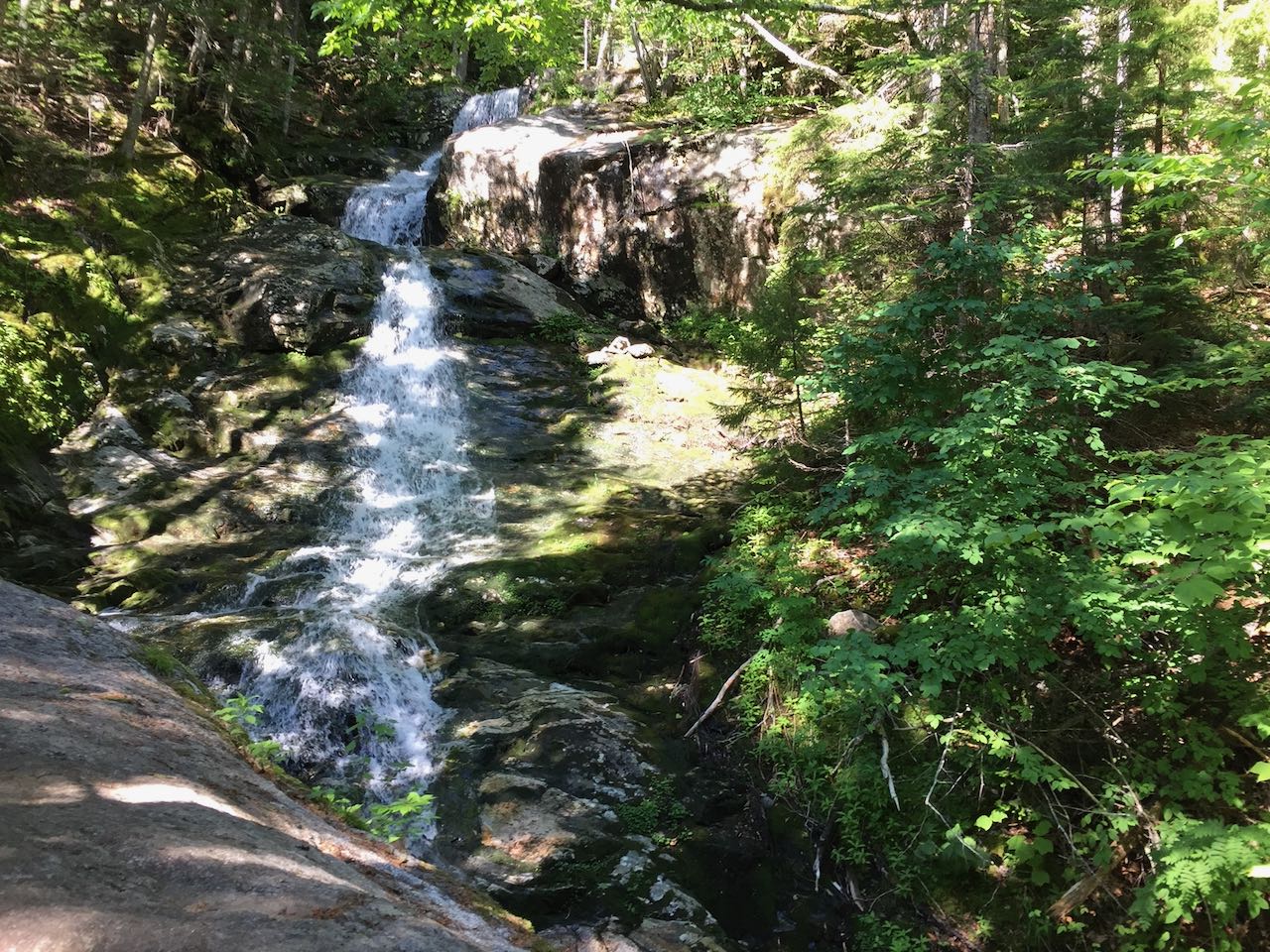
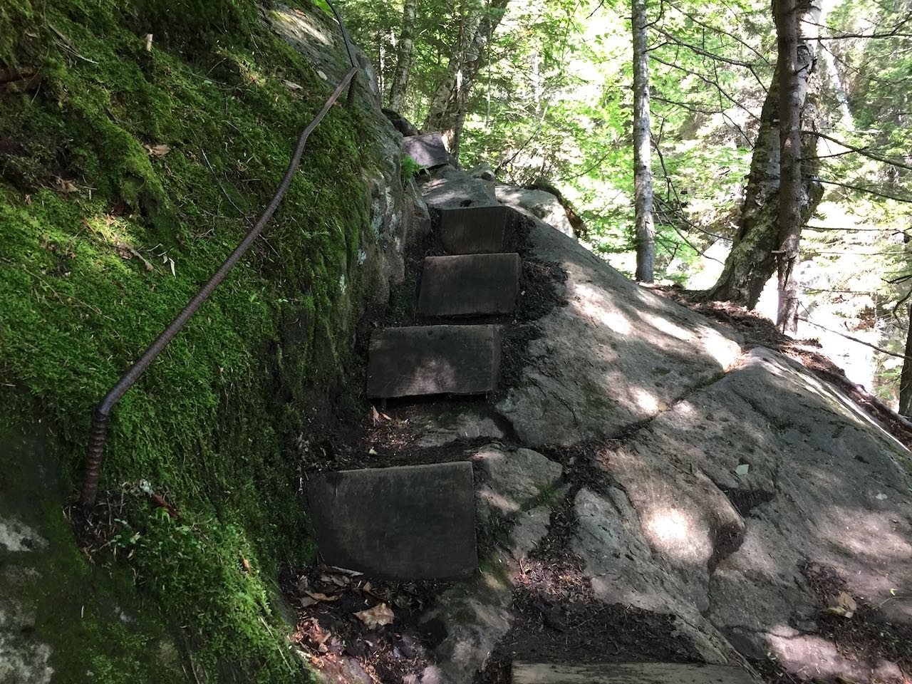
The Beaver Brook Trail up Mt. Moosilauke is notorious - either for being extreme, fun, or scenic, depending on who you talk to. In reality, the section of the Appalachian Trail climbing the steep northeast side of "The Moose" is all of the above. The prime feature of the trail is the extensive chain of waterfalls, unparalleled in the White Mountains. Many other waterfalls are singularly more impressive, but nowhere else can boast the sheer density of cascades that span a 0.7-mile long section of this trail. Every one of the at least dozen discernable waterfalls is individually worth the hike out to by itself, and when combined, they serve up a uniquely wonderful scenic experience. As mentioned though, the trail touring the series of falls is quite rugged and involves climbing up some rather steep ledges. The difficulty is mitigated a bit by expert trail construction - wooden steps and iron rungs assist hikers to surmount the hardest parts, but the trail can still be quite treacherous if conditions are poor.
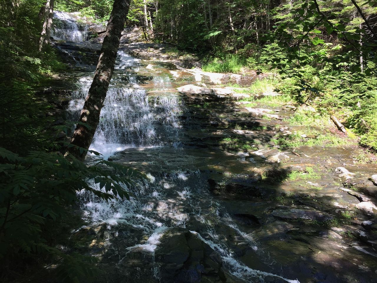
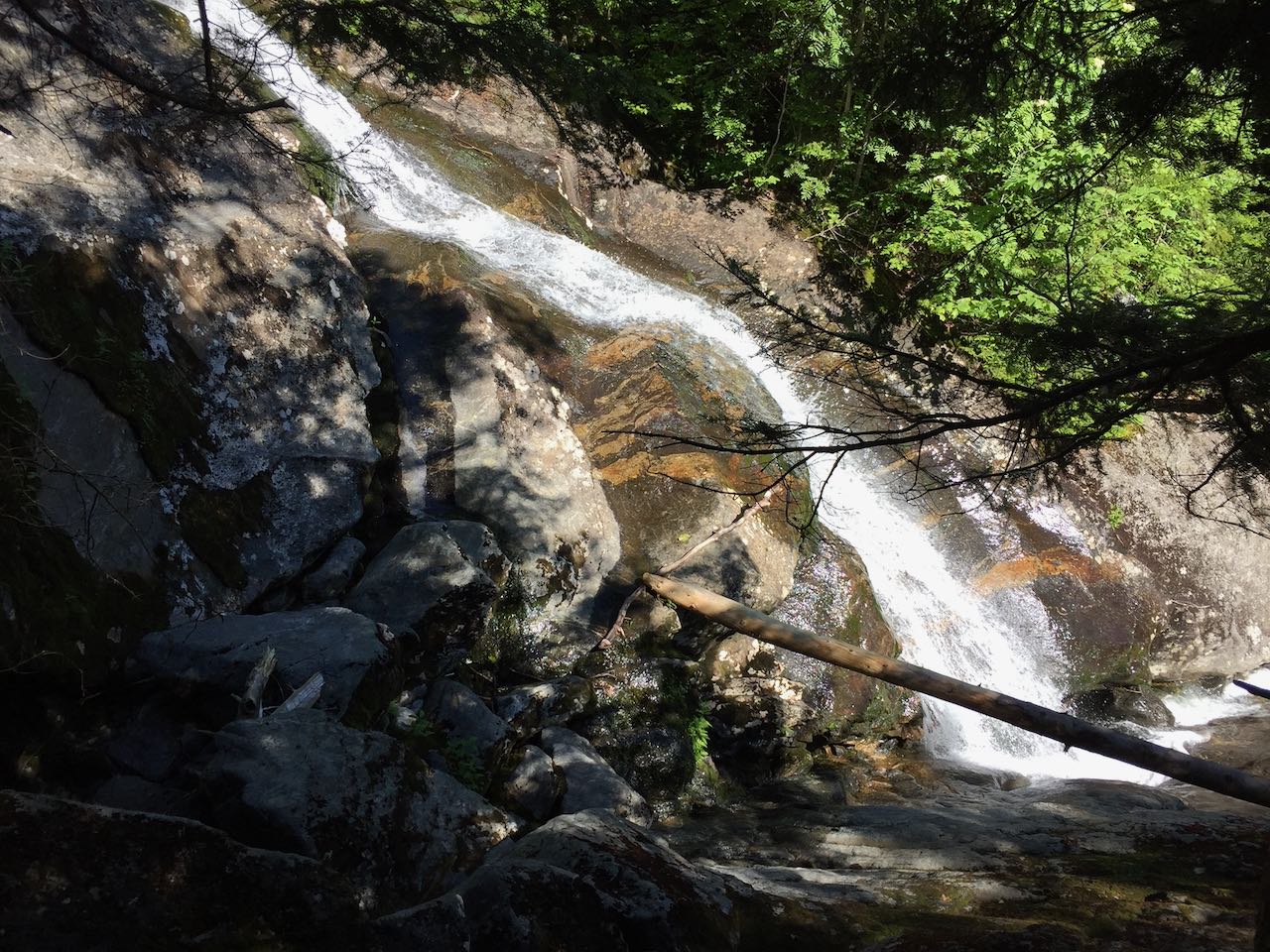
To start your hike, navigate to the kisok at the north side of the parking area (closer toward the pond), and follow the trail to the left. The trail approaches the south end of Beaver Pond, visible through the trees (a scenic wayside just up the road provides a better view), and after 0.1 miles crosses Beaver Brook in a gravelly area just as it flows into the pond. The trail remains relatively level for the next 0.2 miles. It crosses back over Beaver Brook and two other smaller streams on wooden bridges and passes a sign with trail distances and a warning about the rugged nature of the trail. In another 0.1 miles after it begins to incline uphill, the trail opens up to a good view of the very lowest cascade in the chain. The impressive waterfall extends above and below the viewpoint on the trail, flowing down into a little gorge. Just past this, the trail steepens swiftly and you'll encounter the first set of wooden steps. The trail remains close beside the brook as it ascends. The brookbed which forms the cascades is composed of continuous ledge, and the trail surface is a large portion of ledge as well. The trail follows up alongside a string of lower angle, fanning cascades visible through the trees and then comes out to a clear view of a particularly large and wide cascade over an interesting layered ledge. More steps and rungs assist your ascent as you climb through several rock outcrops which require grabbing onto handholds to pull yourself up. You won't have a moment to lose interest in the scenery as you climb, as the brook continues to introduce new scenic waterfalls. Low water-loving vegetation and algaes abound on the long ledge ramps which the brook tumbles down.
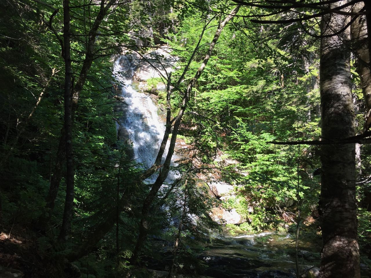
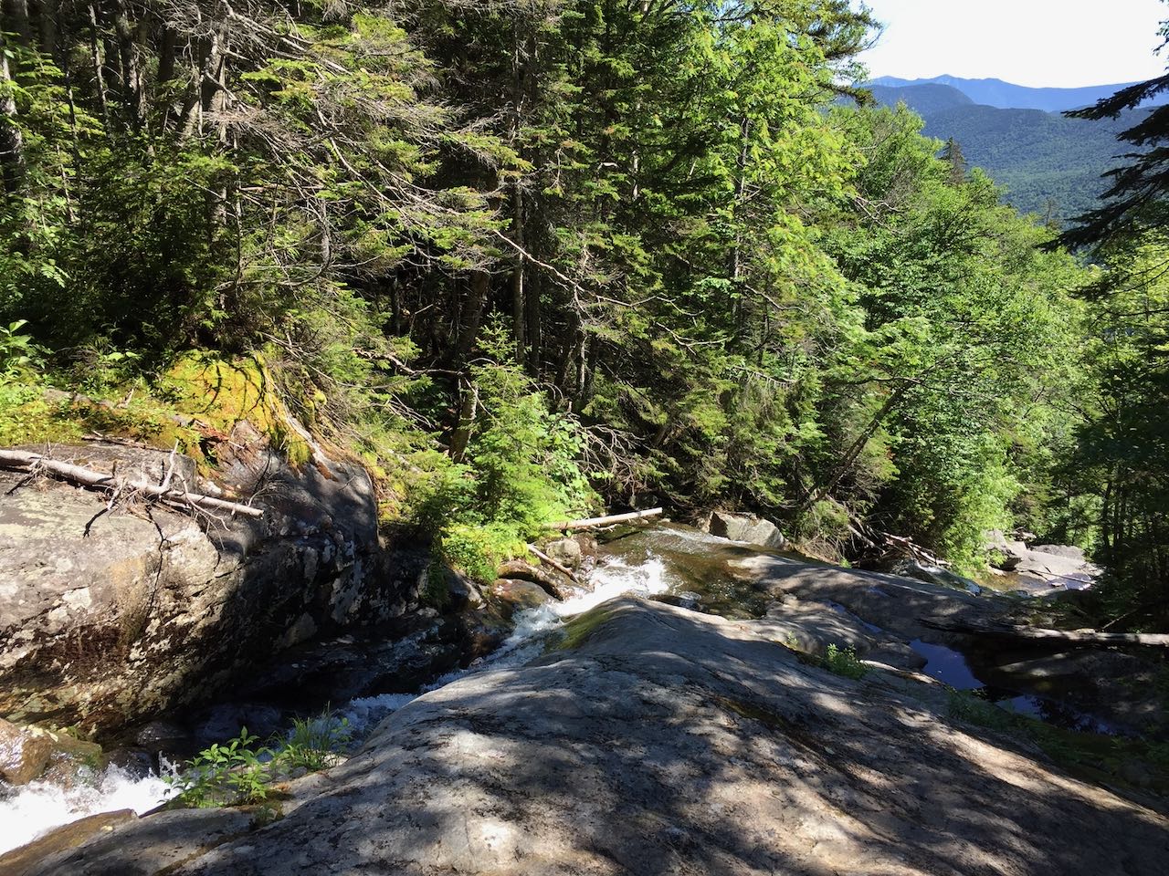
After about 0.3 miles of difficult climbing, the trail reaches an opening right beside the brook, where a plunge-type waterfall is right below you, and you have a clear view upstream a ways to a beautiful, fanning waterfall. Continuing further up the trail, you'll soon pass closer to this waterfall and be able to view it through the trees. More wooden steps follow, including one section that resembles a spiral staircase around a ledge wall, with a view to a cool water chute below. More of the same type of terrain continues for a good distance. Just after passing a lovely horsetail-style waterfall, the trail climbs an impressively built staircase over a long, slippery ledge. Above here, the trail comes out to some open areas in the brook where you can stand beside low-angle cascades and enjoy some views out to the Franconia Range in the distance. Not far beyond this point is where the trail begins to pull away from the brook, just after a long and broad water slide. This will be your turnaround point, 0.7 miles from the beginning of the cascades, and you can revist each stop one more time before leaving!
Printable directions page